
Hold on, what do you mean?
Hold on, what do you mean?
Most companies struggle to get geospatial work done. It's expensive, slow, and manual. As a result, geospatial intelligence feels underused and out of reach.
Most companies struggle to get geospatial work done. It's expensive, slow, and manual. As a result, geospatial intelligence feels underused and out of reach.
It’s a dead end for most.
It’s a dead end for most.
Is there a solution? Asking for a friend.
Is there a solution? Asking for a friend.
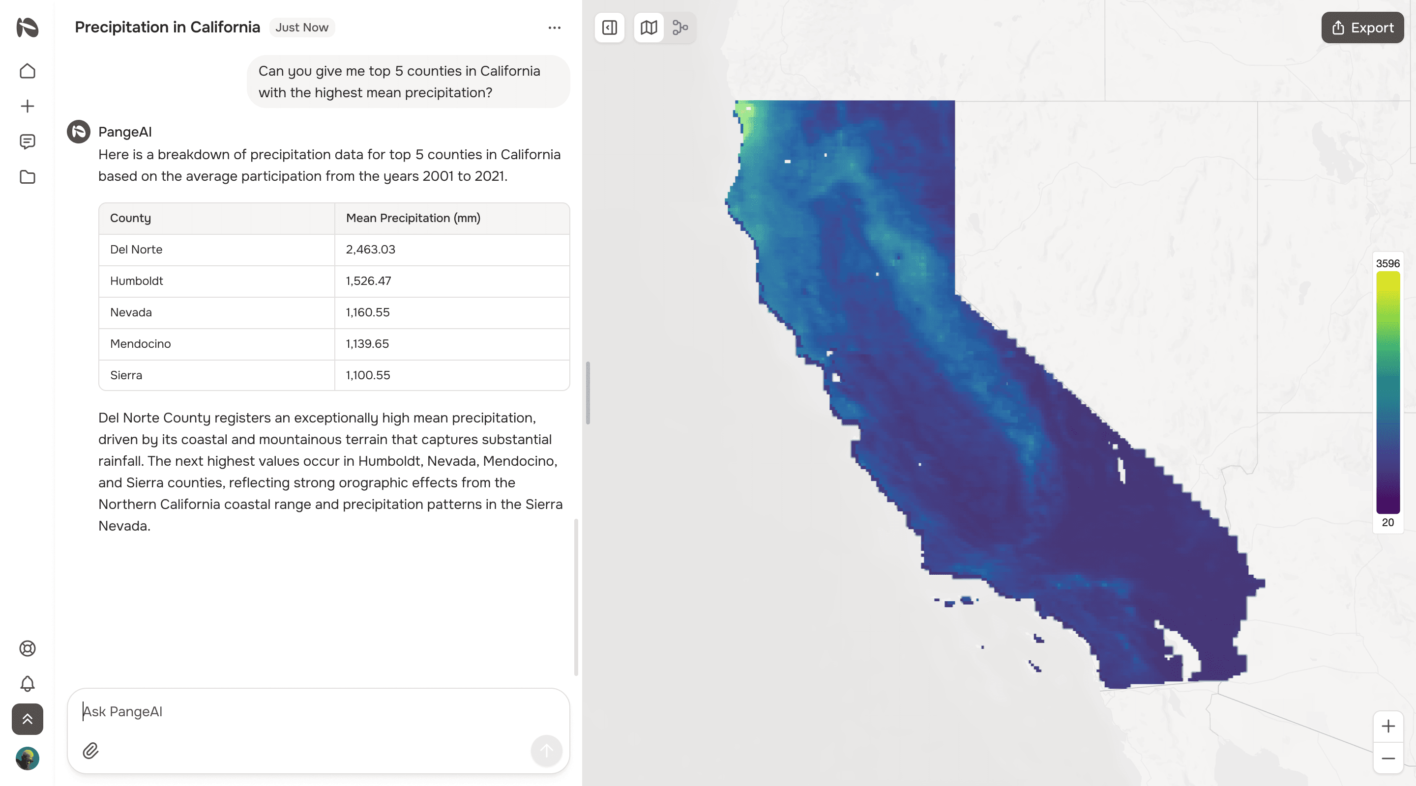
PangeAI is geospatial intelligence for anyone. Powered by autonomous agents, it turns natural language queries into geospatial outputs — no GIS knowledge required. You can get complex spatial analyses within minutes.
PangeAI is geospatial intelligence for anyone. Powered by autonomous agents, it turns natural language queries into geospatial outputs — no GIS knowledge required. You can get complex spatial analyses within minutes.
Feature highlights
Feature highlights
Ask anything in natural language
No GIS expertise required
Ask anything in natural language
No GIS expertise required
Instant analyses & simulations
Agents choose the right methods automatically
Instant analyses & simulations
Agents choose the right methods automatically
Automated data ingestion
Seamlessly pulls from internal and external sources
Automated data ingestion
Seamlessly pulls from internal and external sources